

After visiting the Santuario Virgen de la Esperanza in Calasparra on my rest day, I had a long haul to Cieza the next day. The path followed the base of the front range leaving Calasparra, which was largely barren due to a recent fire. After exiting the burned section, it was nice to see pine forests and shrubs as the road eventually dropped down to the Alfonso XIII Reservoir and Los Almadenes Canyon. With the water on one side of the road and the canyon on the other, the road went through a few short tunnels. There were several people on motorcycles that stopped here for a break. For the rest of the afternoon, the path followed a series of dirt mountain and farm roads. The mountains had lots of rocky outcrops, which reminded me of parts of the Utah in the U.S. The last few kilometers into Cieza were spectacular. A gravel road curved around a mountain above Cieza, and I was suddenly presented with a view of the entire city from above. It only got better, as the road terminated at the viewing spot for the castle that overlooks Cieza, so I had these amazing views of the city with the castle high above, perched on top of these narrow rock columns. I have never seen a castle situated this high above a city in Europe before. Spotting from this castle would have been easy. The day was a bit long and the weather was a bit warm (31°C), but overall this was a fantastic walking day. Nice views and some terrific rewards at the end of the day for the hard work.
There is roughly a 52km stretch between Cieza and El Pinos where there are no towns. I decided to go about half way and camp. The first 5km out of Cieza was not good at all. It followed some major roads with fairly heavy traffic, and little to no shoulder. This first 5km also went through an industrial neighborhood, which I could not wait to exit. The next 10km improved slightly, following dirt farm roads through some degraded farming area. It then turned into pine forest, which was a big improvement. That didn’t last, as the last few kilometers went into a commercial farming area where they were spraying grapes. Finally found a camping spot as the road ascended out of the agricultural valley into a hilly draw that had little cover due to its previous use for almond growing. The ground was too rocky to pitch a tent, so I just put my cot on the ground since it wasn’t going to rain. Overall, this day was a bit dull and lacked good scenery.
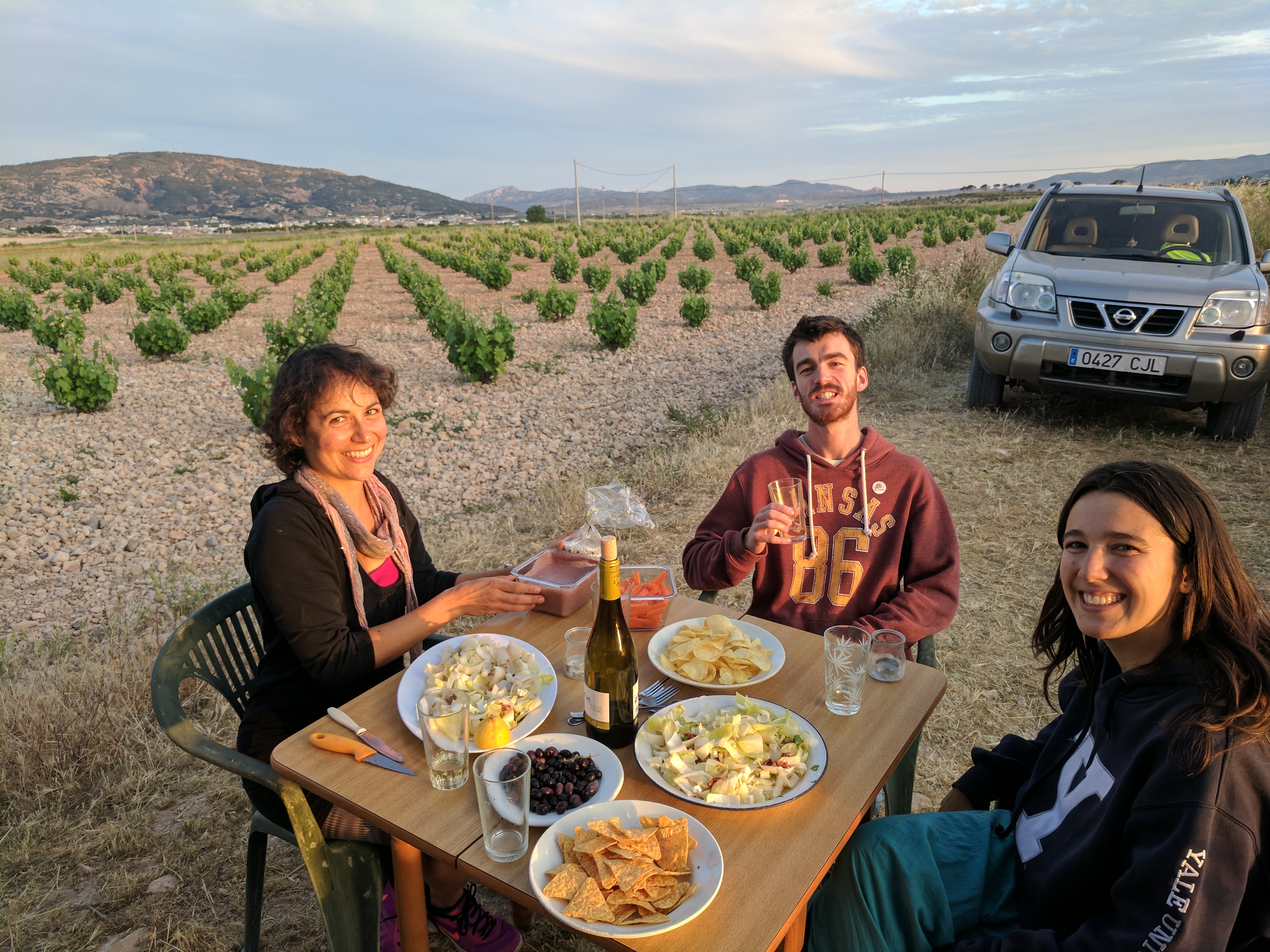
After camping, I was hoping the day into El Pinos would be better than the day before. The first 2km went through the short pine forest before cutting straight through Puerta Jaime, a gap in the hills. Once through the gap, the path charged through the valley farms, but only local farms that had no commercial operations. The walking was smooth, but the weather was still hot and sunny, which started to take its toll on me after a second day of water conservation. It’s difficult to make four liters of water last for two whole days of walking when it is hot and exposed. Since there were no towns, there was no place to fill up. Sometimes you just have to sacrifice and make it work, even if it makes you feel bad. I did come across another walker midday, which has been a rarity on this trip. He was from Spain, and was walking on the GR7 for several weeks. After cutting through farm roads for the better part of four hours, I emerged in El Pinos. While not on the tourist map, it was interesting to see a big table of people from the UK at the restaurant where I stopped for coffee upon arriving, and it was nice to visit with them. Was able to find an Airbnb, where the host had grape fields and was also a yoga instructor. Some friends were visiting her, and we all had dinner in the grape fields, which was a great experience.
The day walking to El Pinos also marks the crossing from Murcia province into Alicante province, which is another milestone.
Walking days: 34
Total distance walked: 905km (562mi)
Weight loss: 6kg (13lbs)

Published by