
The first 10km out of Baza was unremarkable, with mostly industrial area or farms. There was a 1.5km piece where the trail was hardly noticeable, and I had to wade through lots of shrubbery to get past. The town of Zujar was mainly a service town for the farmers, so not much to see other than a cup of coffee, which always looks good. From there the day improved, with a climb on the side of a hill that yielded views over the huge Negratin Reservoir. The path eventually dropped down to the shore of the reservoir, and there was a restaurant overlooking the water. Good thing that the restaurant was there, because my phone decided to freeze and become a brick. The restaurant provided a place to troubleshoot. Got back on the road late, and there was a lot of paved road walking into Benamaurel. The GR7 was not well marked at all, but the green Sendero route was very well marked. Not sure why. Approaching Benamaurel, you can start to see examples of the cave houses that are typical of this area.
The 12km stretch from Benamaurel to Cullar was eroded hills with wheat growing on the valley floor. Cullar was on a main road, and therefore had a lot of service businesses. It was a good stop for lunch. After leaving Cullar on dirt farm roads, I somehow took a wrong turn somewhere, and didn’t realize it until it was too late to backtrack. Fortunately for me, I was able to piece together other farm roads in order to eventually intersect the road I was supposed to follow. This area to the south of Orce was quite nice, with lots of flowers and elevated views across to all of the neighboring mountain ranges. This was a long day, but finally made it to Orce, a pretty little town with a castle situated right in the center. As with the previous day, the waymarking was scarce. I was lucky enough to stay in a local cave house, which was a wonderful experience. The cave houses are common around Benamaurel, Cullar and Orce.
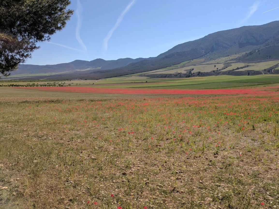
Leaving Orce, the path followed farm roads that weaved through the eroded hills that the locals use for cave houses. Some cave houses are old and abandoned, while others are in pristine condition. The characteristic red poppies were thick in this area, and the red just screamed for your attention. It’s funny, for as many times as I have seen these poppies during my trip, they still make me happy and it is difficult not to keep taking the camera out. A few kilometers outside of Galera, I followed a dirt road that was supposed to be the path. This road went for about a kilometer or so, and then abruptly terminated at someone’s freshly ploughed farm. Instead of traipsing through the farm in search of road remnants, I decided it was best to backtrack and just eat the extra 2km that it took to get that sorted. I didn’t stop in Galera because it was a bit off of the road, and I was eager to put the paved walking behind for the time being. The last 8km into Huescar meandered through farms, with the red poppies shining bright. Huescar is a sizable town, but it was largely quiet because it was Sunday. Still managed to find an excellent beef and tomato racion for dinner.
Continuing the walk on Monday morning, there are no towns on the path between Huescar and Puebla de Don Fadrique. While the first 16km had great views of the valley, it was super straight, flat, and paved. That got a bit old after a while, and it didn’t help my heel blisters. After the road reached the mountains and pine forest, it turned into a well maintained dirt road that climbed out of the Huescar side of the valley and eventually descended just behind Puebla de Don Fadrique.
The waymarking from Baza to Puebla de Don Fadrique was mostly poor. There were only a handful of markers, and they were not particularly helpful. The waymarking did start to improve about 7km before Puebla de Don Fadrique. Hopefully that continues moving forward.
Reaching Puebla de Don Fadrique is a bit of a milestone on the GR7 in Spain. It marks the convergence of the two variants (mentioned previously). I took the ~440km southern variant, to the south of the Sierra Nevada National Park, but those who choose the northern variant would enter Puebla de Don Fadrique from the north. The converged GR7/E4 path then continues east towards Almaciles.
Walking days: 27
Total distance walked: 722km (449mi)

Beautiful picture of the poppies!