

Unlike the previous few days into El Pinos, the day from El Pinos to Elda-Petrer had a small village in between (Casas del Senor), which helped to break up the monotony of the farm roads. While there was some nice scenery during the day’s walk, the majority of the time was spent on paved minor roads. A bit more paved road than I like, and I could feel it in my feet when the day was drawing to a close. Been trying to shake a minor case of Plantar Fasciitis in my left foot, which I have had since Moratalla. This didn’t help much. Elda and Petrer are two cities that are essentially joined together, and at around 60,000 people, this is the largest urban area I have walked through on my trip. When approaching a city of this size, it takes some time to wade through the industrial areas on the outskirts and get past the busy arteries. In this case, it took about an hour to get into the heart of the city and find the Airbnb on the street that forms the border between Elda and Petrer. Elda was a bit more modern and seemed to be the business center, while Petrer was largely older and nestled into the hillside with a castle standing watch. The view over the cities from the castle was outstanding.
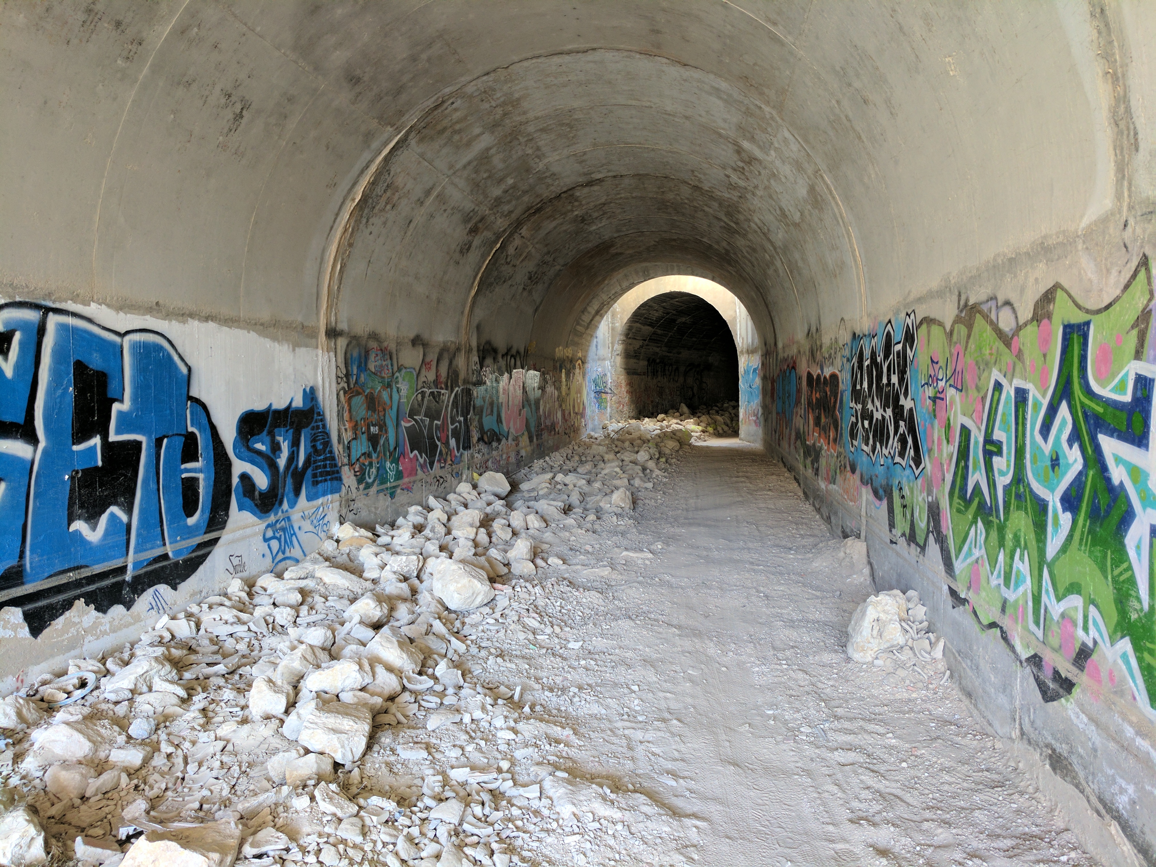
Leaving the Elda-Petrer area required some navigating around a maze of busy roads, which included an interesting pass under a major highway using the graffiti-laden drainage tunnels.
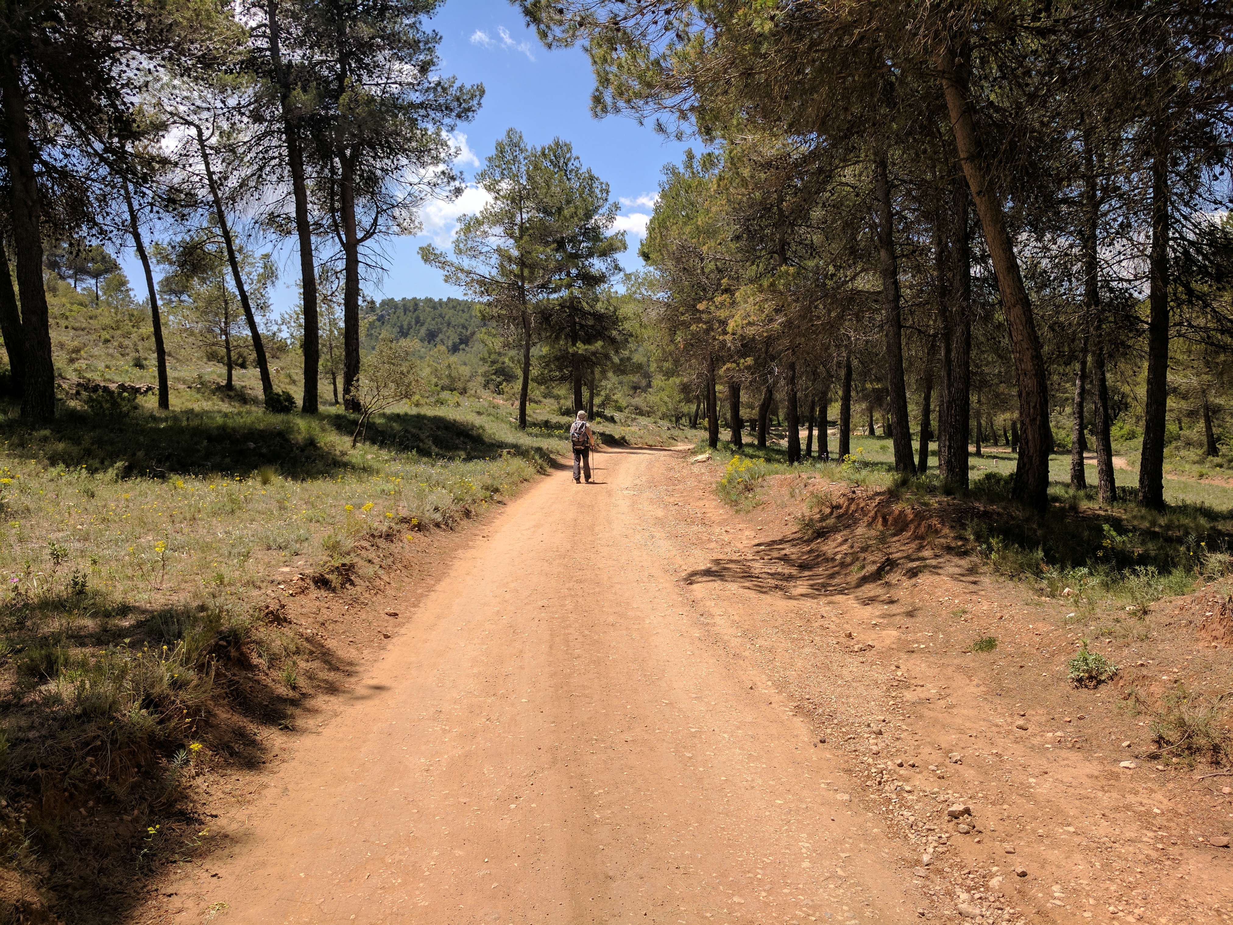
After leaving the urban area behind, the road emerged in a green and rocky valley, which even had some sand dunes. I saw a few people trail running and mountain biking in this area. I was stopped in this area by a Petrer municipality worker, who thought that I was a peregrino on pilgrimage via the Camino Cid. He thought I was on the wrong path, but was happy to hear that I was on the GR7 instead. The path then followed a dry creek bed momentarily before hitting a series of unmaintained dirt roads. One of these roads was quite rough, and had taken some water damage. This made the stiff climb out of the hilly valley slow going. Once cresting the high ridge, it was a gradual descent through pine forest and some rural sprawl from Castalla. After navigating the new part of town, I arrived in the old section of Castalla, which was bent around the hill that was home to the fortress. Castalla has a number of UK expats, and I talked to a few of them about my journey over a coffee. Also managed to get a haircut and beard trim, as I was looking a bit ratty. Took an early evening walk up to the castle, but it was not open.
Castalla is also on the Camino Cid, and I had a similar experience to Elda-Petrer where I was stopped by a local farmer about 3km into the walk to Alcoy and told that I was going the wrong way. Once out of the valley, the rest of the way to Alcoy was great walking. There was a tangle of dirt roads that went through the forested hills, followed by a trail that cut across the top edge of a very high ridge. From there it looked like I was on the highest point around, and I started to catch glimpses of Alcoy. The path entered the Parc Natural de la Font Roja, which was fantastic. The park was very well maintained and had great signage. It had beautiful forest and rest spots, and ample photo opportunities being that high above everything. If you happen to be in Alcoy, I would highly recommend spending a few hours exploring this great park. The road gradually descended towards Alcoy, and I stopped to make some broken Spanish chit chat with one of the Font Roja park managers that had stopped to assist a bus full of students that somehow lodged itself in a hairpin turn, damaging the bus and the road.

Bus freed, I finished the day in the old part of Alcoy. Central Alcoy was a very busy place, and the square packed with people once the sun started going down. Everyone completing the daily Spanish ritual of coffee+beer+wine, followed by more coffee+beer+wine, and then finishing the night with a slow stream of tapas that usually runs late… accompanied by coffee+beer+wine of course.
The walk out of Alcoy was quite dramatic, as it passed through a gigantic cut in the rocks that is visible from Alcoy. At times the path was a constructed rock wall of sorts. After clearing this cut, the path was reduced to a trail that made a steep climb up the mountains through an area that looked like it had burned during the last year or two. After traversing the high mountains, the trail dropped down a bit to some dirt roads that carried me through the rest of the Parc Natural de la Serra de Mariola. I saw quite a few people this day, with lots of day hikers, trail runners, and a few mountain bikers. I also overtook this guy, who was spending a week on the GR7.
Nearing the medieval town of Bocairent, I decided to deviate a bit from the GR7. I took a trail that dropped down into the valley, just short of the old part of town. I did this because I was staying in the old town, but also because this entrance into town provided some very good photo opportunities. I took a rest day in Bocairent because there were some sights to see, and because there is a lack of good places to take a rest day in the upcoming sections. Bocairent is very photogenic, but I like the feeling of not being able to stop taking photos. On the rest day, I visited the Moorish caves (Covetes dels Moros) and the Ermita del Sant Crist. The caves were amazing, but not for people with claustrophobia. You spend much of the time crouching, and there are times when the openings between rooms are not much bigger around than a person.

Quite a few people needed help climbing through some of the openings. The Ermita del Sant Crist was nice, but I thought that the walk up to the Ermita del Sant Crist was the most interesting part. The cobbled paths and bridge were very old, and you felt like you were walking on a very historic path. The views over Bocairent and the caves were great. Bocairent did have some tourists, but almost all of them were from Spain.
The day from Alcoy to Bocairent also marked two milestones. First was the crossing from Alicante province into Valencia province. Second was surpassing 1000km on the walk so far.
Walking days: 38
Total distance walked: 1007km (626mi)

Photos glorious. What history! Caves astounding, but yikes — no thanks…glad YOU took the photos. Quite an experience — after Oregon caves, no more caves for me. Congrats on 1007 km milestone. Hope you have soft paths and plantar f…. eases. Be well.
The pictures of Bocairent are breathtaking. Loved every one.