

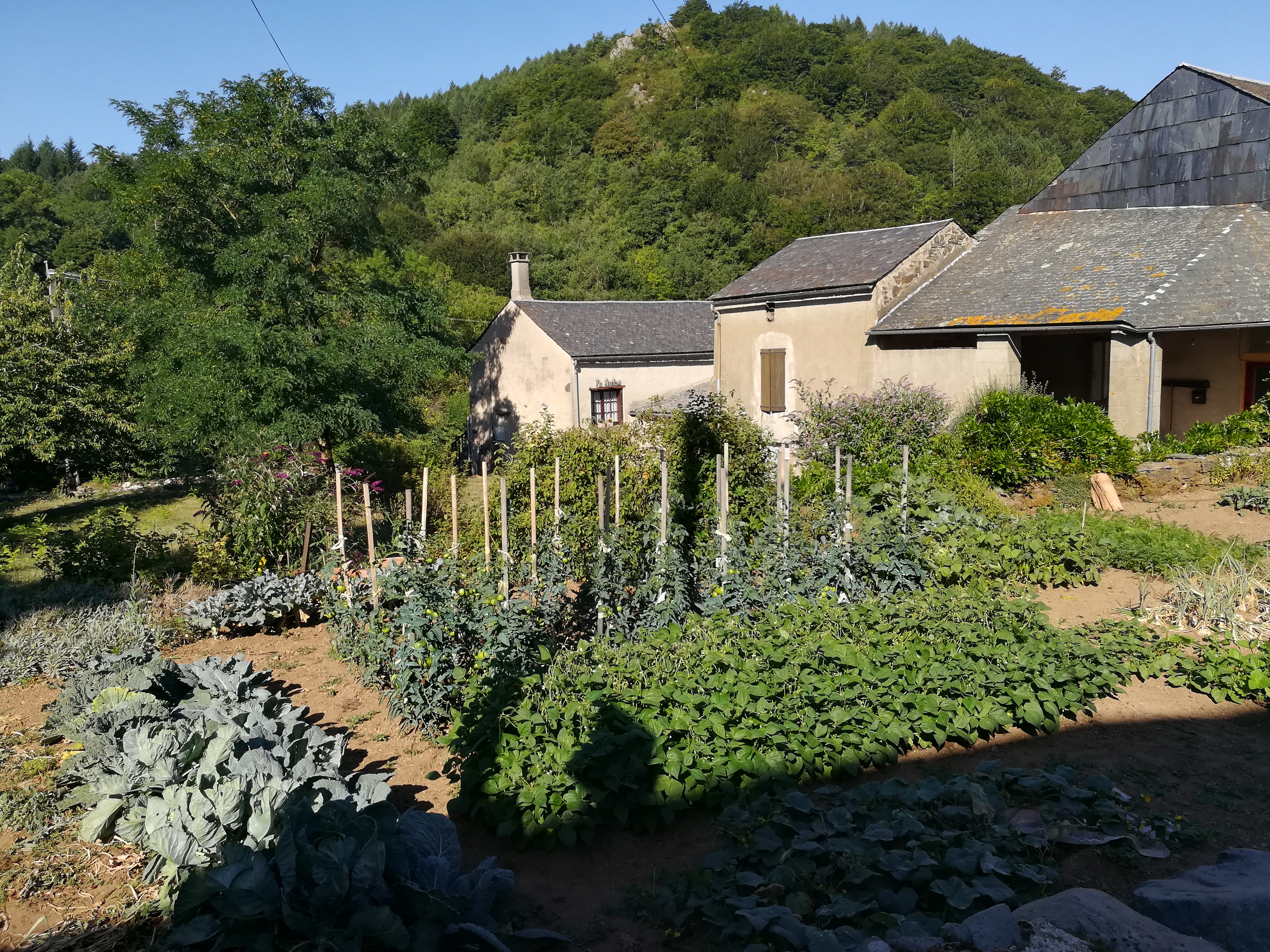
After camping a few kilometers past Fagairolles, the first half of the day was spent making my way through a small valley to the village of Melagues. The way was not very exciting, but the village of Melagues was quite nice after the bland morning. The locals were gardening in the central vegetable gardens, and with the nice church as a backdrop it made for a relaxing place to take a quick break for water at the fountain.
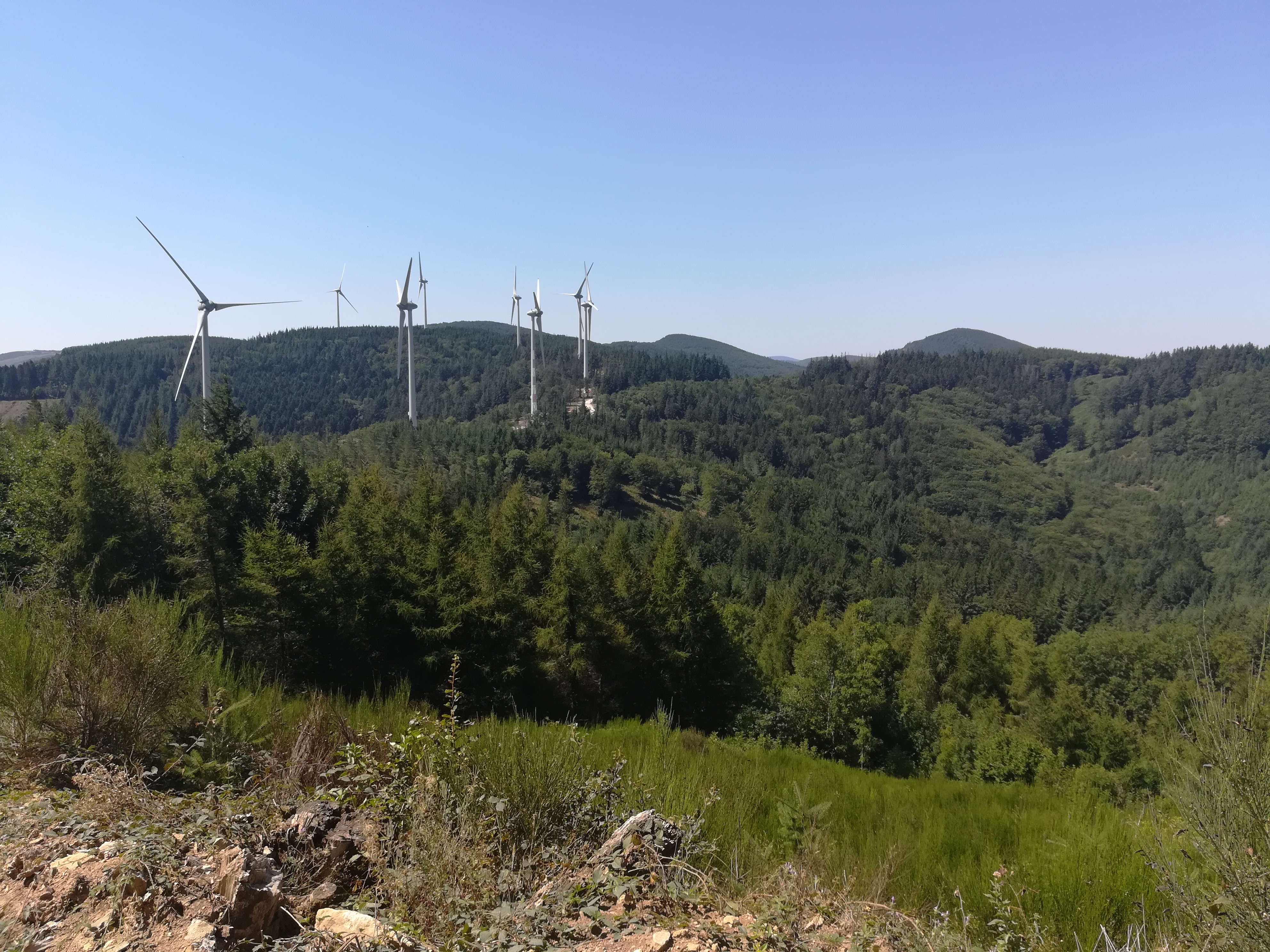
The afternoon turned into a long a confusing affair. First, the temperature reached 37°C (99°F), so the exposed spots were challenging. Second, the path was supposed to run through the hills on dirt roads outside of Ceilhes et Rocozels, but I ran into an area where energy companies were installing and testing new wind turbines. The roads in that area were few and far between, so turning around or choosing another road would have blown out my whole day. The installation areas were marked with “closed to the public” signs, but I sheepishly went through hoping to avoid trouble. While I was passed by several workers in cars, luckily I did not get into any trouble. I’m not sure if the GR will go through that area in the future or if they will reroute it, but it seemed to be an area in flux.
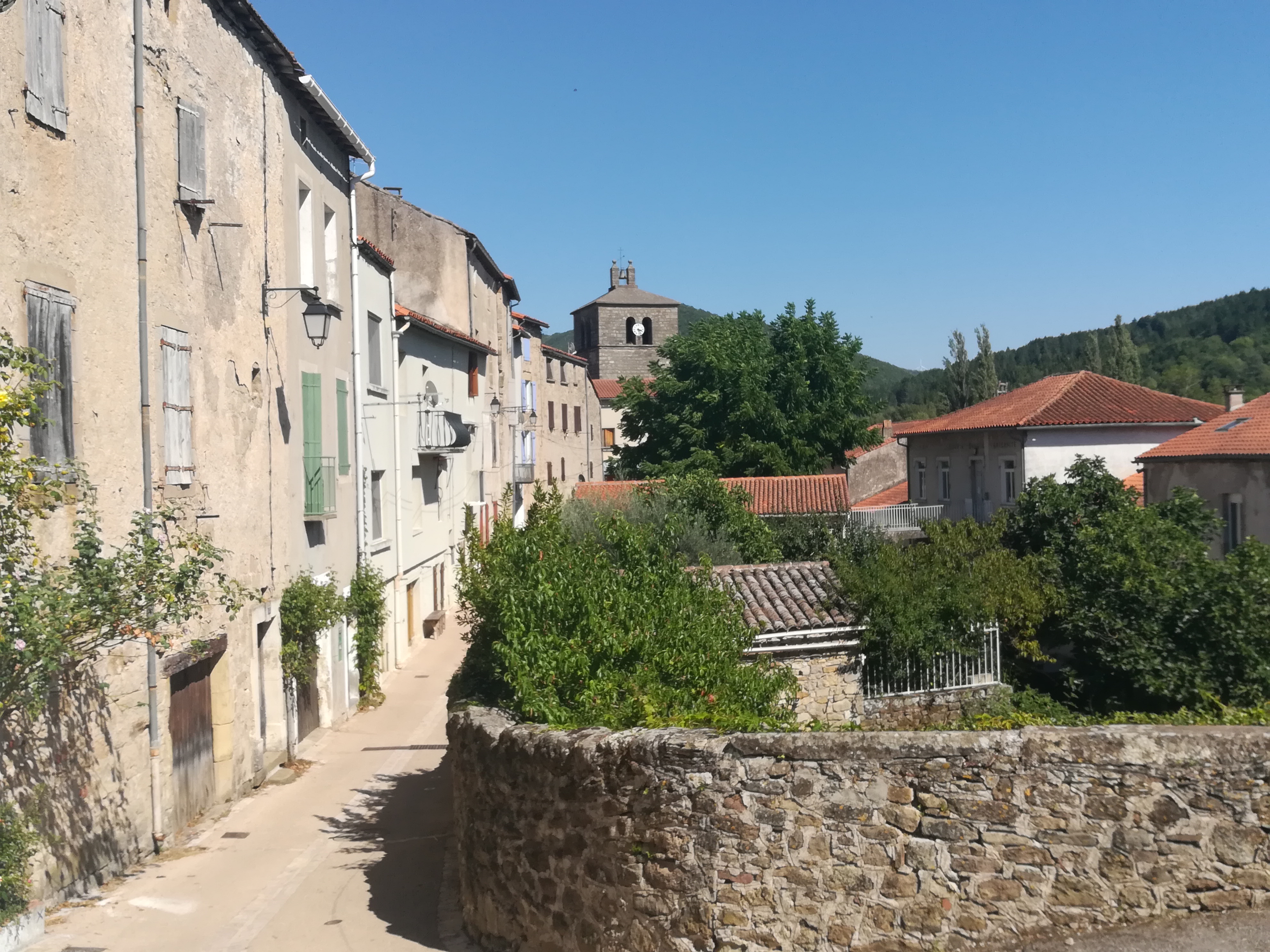
After sneaking through, I continued downhill in a lather of sweat, and finally pulled into the lakeside village of Ceilhes et Rocozels. Given the hot day, people were enjoying the lake and the nearby cafe to cool off. I got some strange looks as I stumbled into the cafe soaking wet with sweat, but I’m kind of used to that these days. Stayed at a nice old house converted to small hotel, which was a temporary escape from the heat.
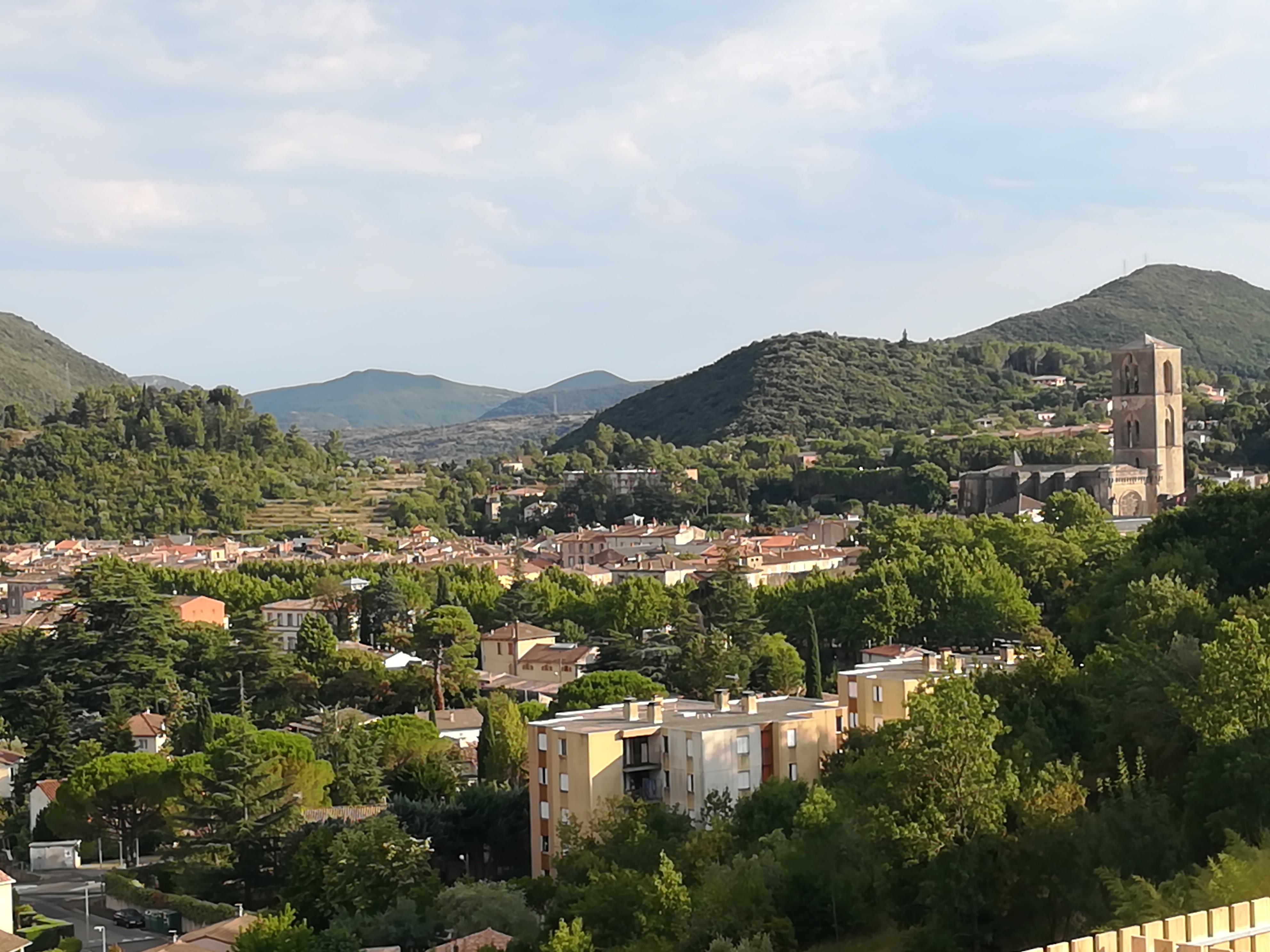
The next day was slated to top out at 35°C (95°F), so I got an earlier start to avoid the heat. The first 7km was along the paved road, so that proved to be a good decision. After that stretch and a bit of dirt road I arrived in the small village of Roqueredonde, where there was a town festival to liven up an otherwise sleepy village. This mostly consisted of a large food and drink tent with lots of socializing and shade. I did have a quick lunch here to support the village before carrying on. After a few trails, the path followed the VTT (national mountain biking route) for a bit before changing to forestry service roads that crisscrossed the hills outside of Lodeve. A rocky bit of downhill trail finished the day to Lodeve, a town that seemed large after many days of smaller villages. I had an Airbnb in Lodeve with a very nice family, and we talked about my experiences thus far.
A few kilometers out of Lodeve was Foziere, which was a tiny village but had a nice castle tower that I could see for quite some time before arriving.

After Foziere and a bit of a climb, the path followed a lot of dirt forestry service roads, which were a bit monotonous but easy to follow. Although the temperature had cooled by a couple of degrees from the day before, the exposed hilltop areas without forest felt pretty hot. Got a bit of shade on the descent into La Vacquerie, which was a beautiful place. Too bad it was Sunday and everything was closed, as I would have liked lunch there.

After La Vacquerie, there was a lot of exposed and very dry area with low shubs. Walking through the dry grass areas in the sun left a bit to be desired, and I felt tired as I finally finished the traverse of the exposed land near the Navacelles canyon. I spent a couple of hours in the village of Saint Maurice Navacelles cooling down and exploring. There was no accommodation in Saint Maurice Navacelles, so I waited until evening before heading about 1km outside of the village to the canyon rim for camping. This was a great camping spot, and the canyon views were nice in the evening.

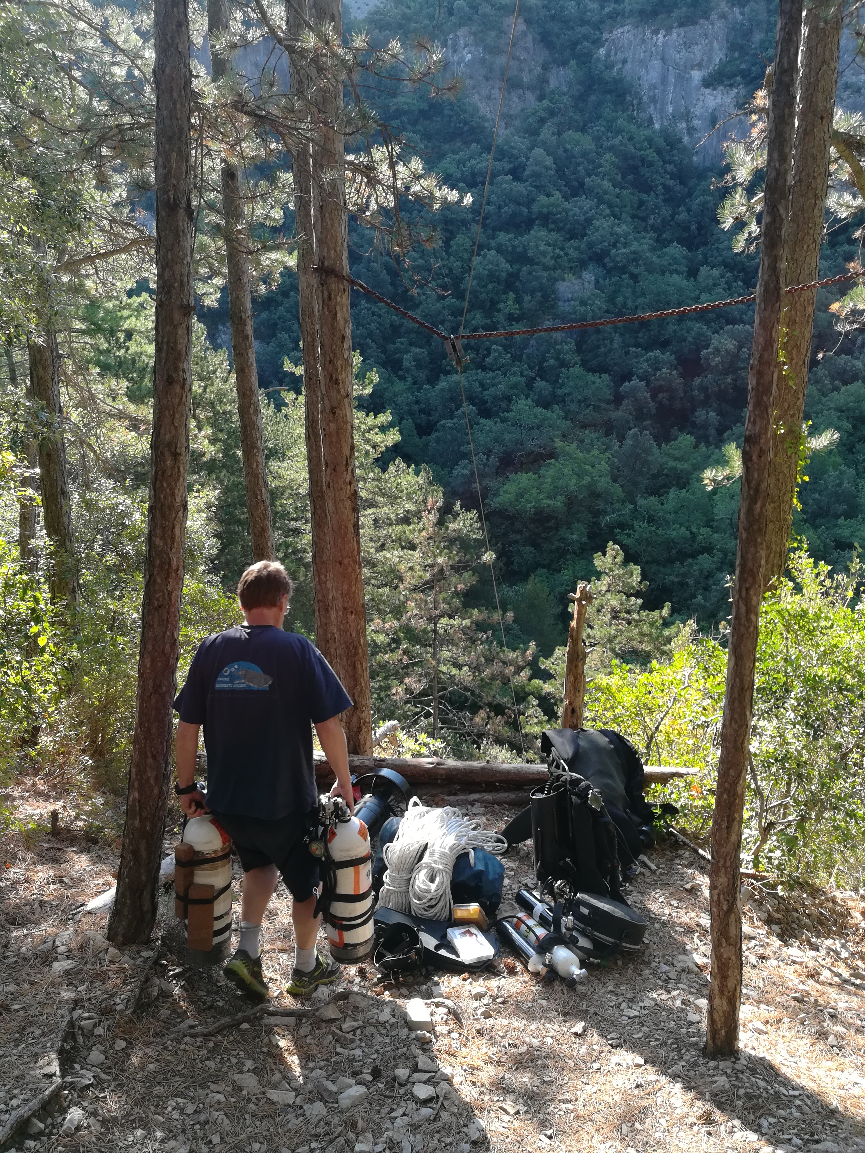
I woke to the fact that I now needed to traverse the canyon by descending into the canyon, following the river to the village of Navacelles before climbing back out. The descent into the canyon wasn’t as bad as expected, but it was quite rocky. Once reaching the dirt road near the river at the bottom, I ran into a guy that was preparing to solo dive in the extensive cave system under the river, which was surprising.
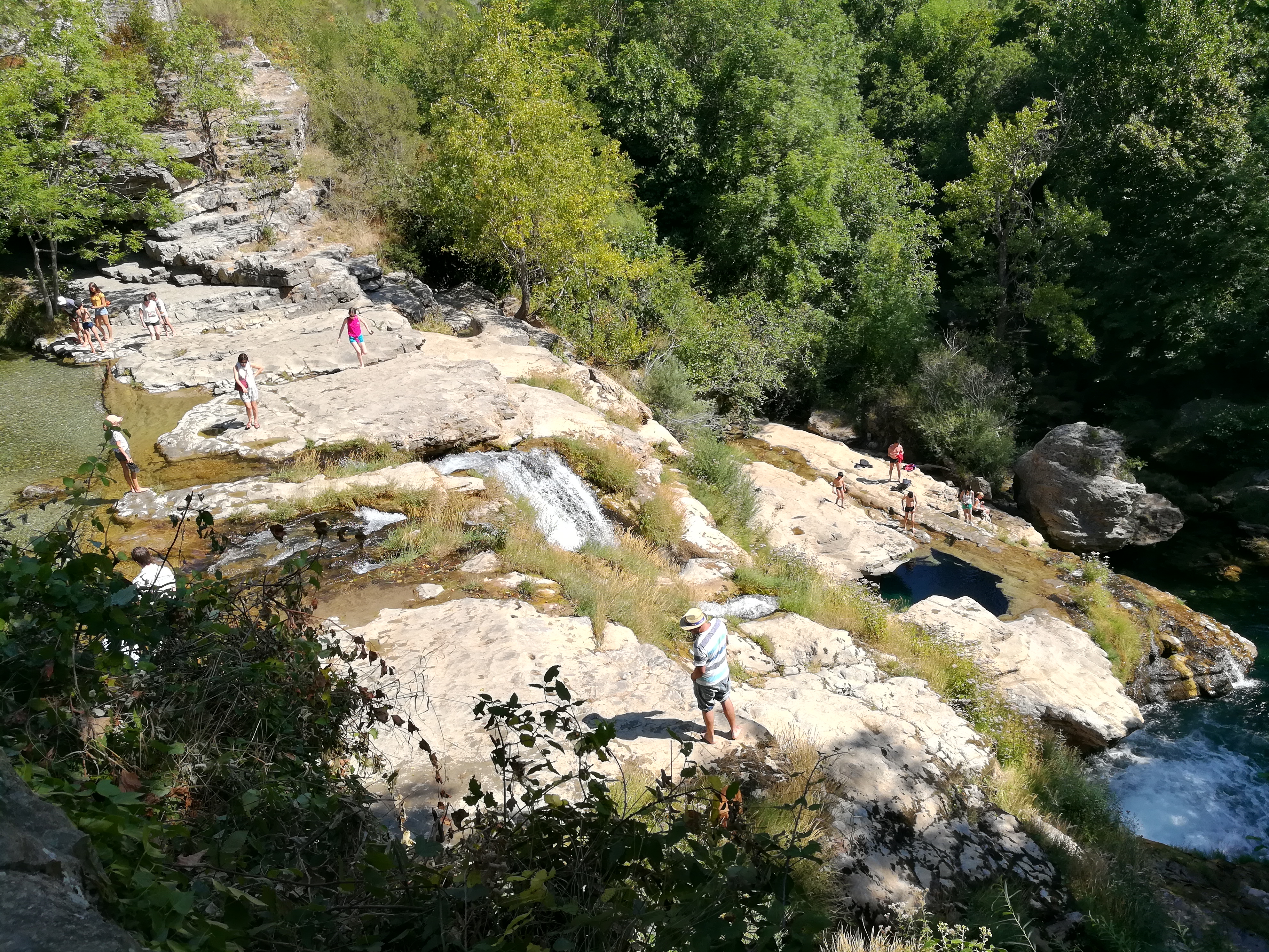
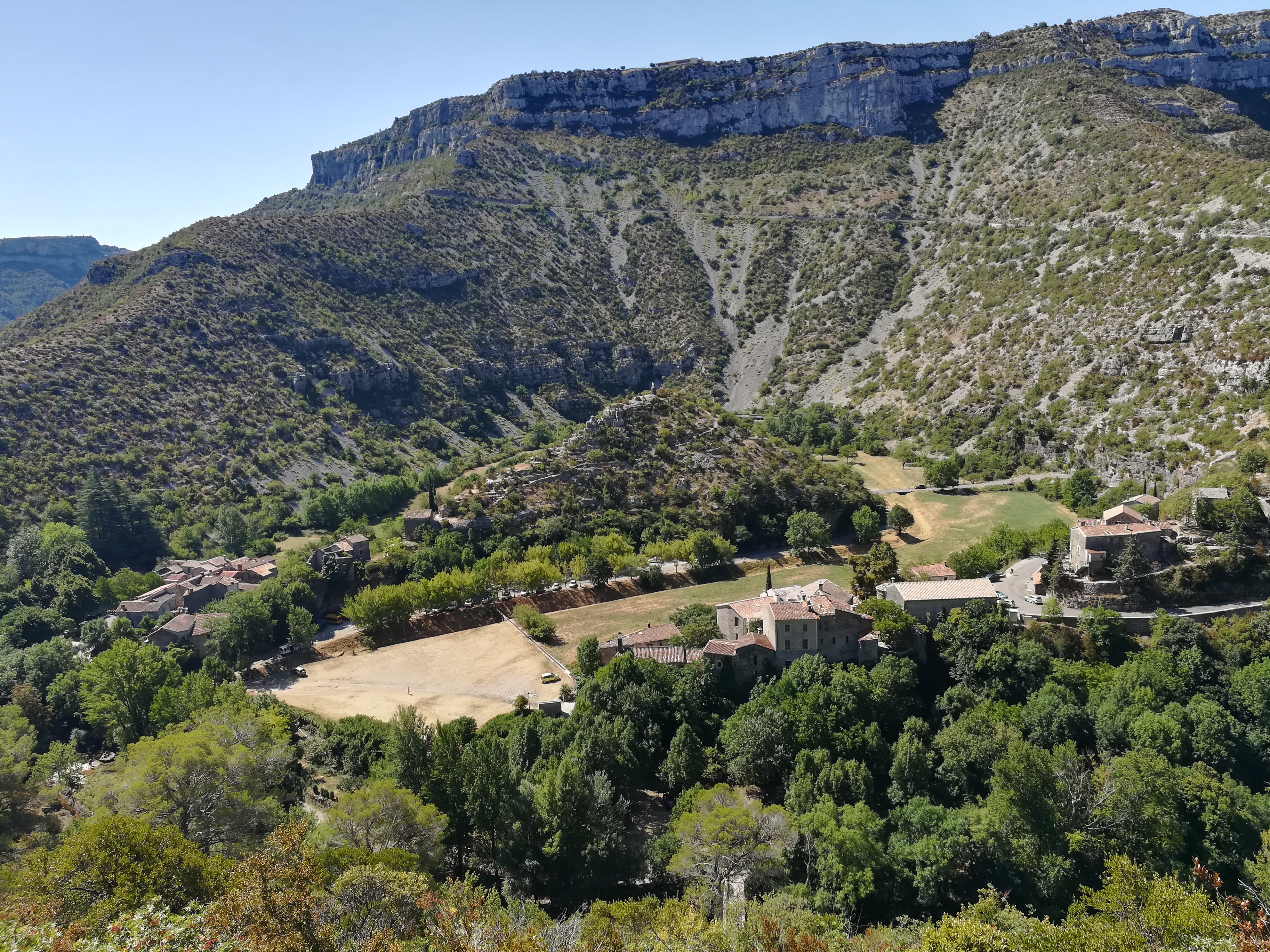
The dirt road followed an aquaduct above the river for some time before it turned into a single track trail for the rest of the canyon excursion. Upon rounding the last corner, the canyon opened into a big horseshoe and Navacelles came into view. This was an amazing place. The village sat at the river’s edge, while the access road was delicately draped around. I could see cars holding up other cars as they clambered to take in the views or stop for photos. People swam in the river next to the waterfall, which had a dark hole leading to an underwater cave below. There were a few tourists here, but amazingly not more. This place had that wow factor. Even after leaving the village and climbing out of the canyon, I kept looking back in amazement.

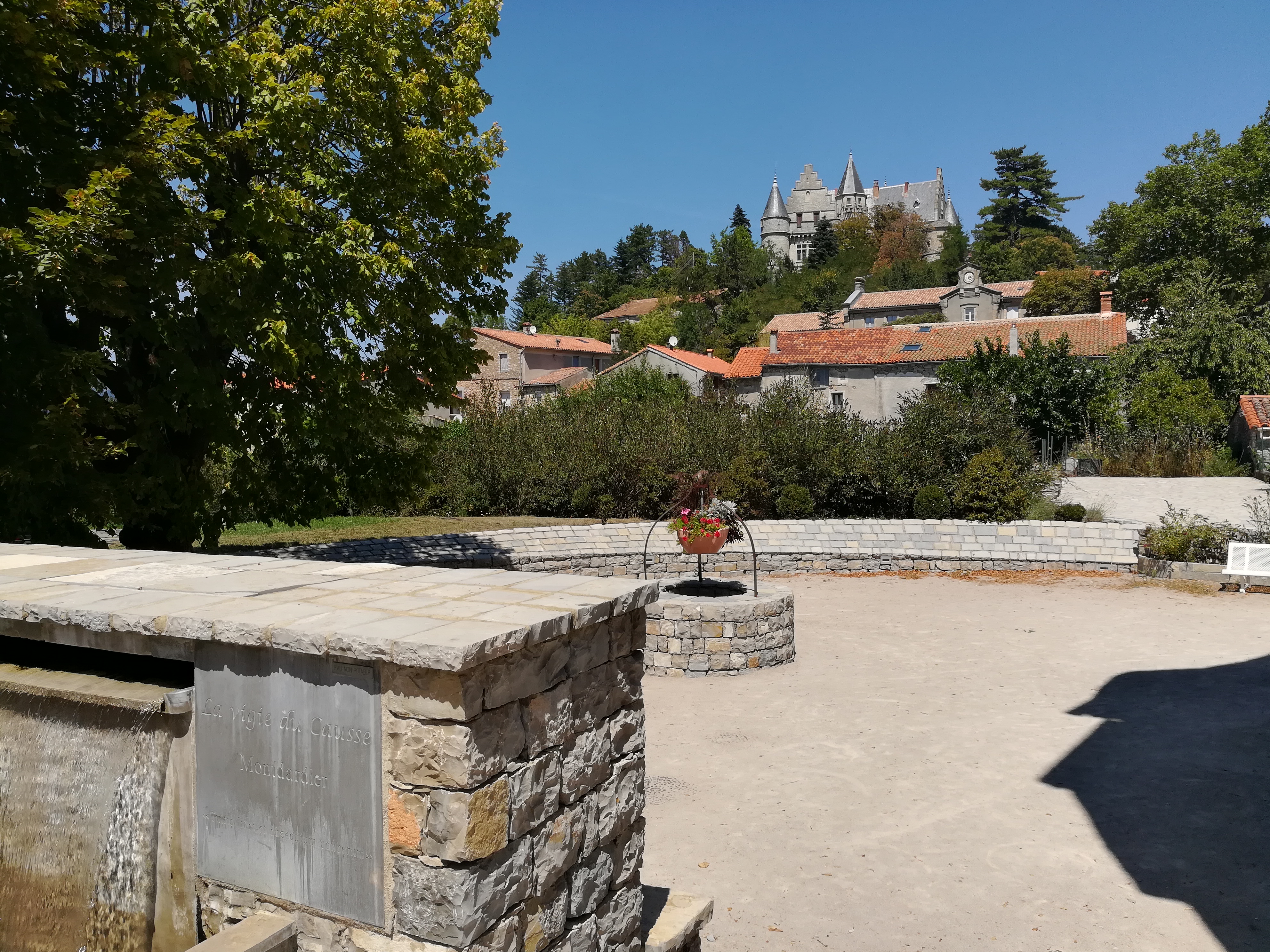
This day was really a tale of two halves. The first half through the canyon to Navacelles was spectacular, but the other half was not so nice. There was a lot of dry, hot shrubland. The lack of rain had turned much of the shrubbery brown, and the path had a spot that was redirected without a clear indication of the new direction. I ended up walking on an old trail with faded markings that eventually hit a road where the gate was locked, and there was a sign stating that the trail was no longer there. I had to abandon and take to the paved road in order to get to Montdardier, which was an otherwise bright spot in a lackluster afternoon. Stopped for a quick coffee and castle view before the last push to Le Vigan.
The last few kilometers into Le Vigan was mostly more of the same, with dry area and semi industrial stuff. It only improved during the last 2km downhill into Aveze and Le Vigan. Spending a rest day token in Le Vigan before continuing.
My feet are starting to swell again due to plantar fasciitis, so hopefully I can keep that under control. Have a major milestone coming up in the next week, with the crossing of the Rhone River. Looking forward to that!
Walking days: 88
Total distance walked: 2516km (1563mi)
Weight loss: 14kg (31lbs)

Published by